WINDSOR, N.S. — Environment Canada is warning that a severe weather event will be hitting Nova Scotia on Jan. 4, with snow, rain and high winds.
According to Environment Canada, long range forecasts show that the system is approaching from the southwest and passing over western Nova Scotia Thursday night.
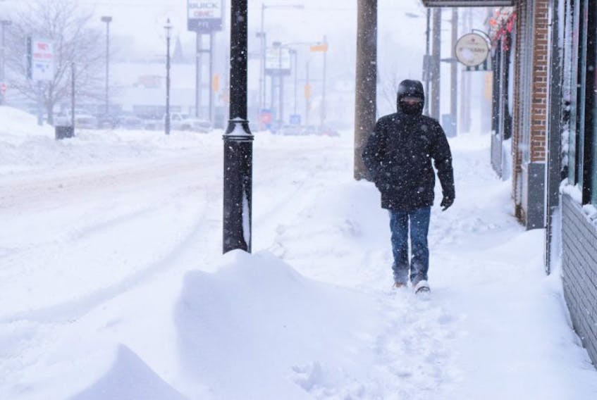
The agency warns that potential impacts from this storm include possible power outages, deteriorating travel conditions or delays, and potential school disruptions.
Snow is expected to develop Jan. 4 in the morning and spread northward across the province, with a changeover to rain for most parts of the province later in the day.
Early snowfall estimates range from 15 to 30 centimetres for most of the province. Rainfall amounts of 20 to 30 millimetres for southwest Nova Scotia are expected.
Easterly winds will strengthen with gusts of 90 kilometres an hour or more Thursday afternoon. Winds will shift Thursday night in the wake of the storm.
Southwesterly gusts reaching upwards of 120 kilometres an hour along Atlantic coastal areas of the province are possible. Strong winds combined with snow will lead to poor visibility before a likely changeover to rain.
Environment Canada is also warning that the potential for storm surge along Atlantic coastal areas is very high, as high tide will coincide with the strong winds and high seas Thursday evening. Large waves and elevated water levels will persist into Friday morning.
Meteorologist explains storm's expected intensity
Ian Hubbard, a meteorologist with Environment Canada, said that although the storm is still pretty far off, it’s currently tracking to hit Nova Scotia dead centre on Jan. 4.
“This storm is still in its initial stages of developing this morning off the coast of Florida, so it’s a ways away for now,” Hubbard said the morning of Jan. 3.
“But as this moves up the Atlantic Coast, it’s going to stay off shore, but as it tracks north, the warm air and cold air will start interacting and that’s where it’ll get the energy from,” said Hubbard.
“As this is pushing up within the next 24 hours, it’ll start to really draw in the cold air from the northwest and the warm air from the east,” he said. “As that continues towards Nova Scotia it’ll continue to intensify and it’s going to be a very low-pressured low pressure system.”
Hubbard said the centre of the low pressure system is expected to be around 949 millibars, a unit of pressure, just south of Nova Scotia, which he said makes for a really deep low pressure.
Low-pressure systems are typically between 950 and 990 millibars Hubbard said.
“That creates a lot of wind with this storm, which is why we have a lot of wind warnings out for the South Shore of the province,” he said. “We’re expecting high winds before the storm, during the storm and behind it as well.”
Part of the reason for that intensity is the arctic air mass that has caused frigid temperatures throughout much of North America in the last week, Hubbard says.
“This would be considered a baroclinic storm, which just means it’s drawing its energy from the warm and cold air,” he said. “The cold air we’ve had lately is one of the sources and the warm air out over the Atlantic is where it’s drawing that energy from.”
Hubbard said he hesitates to call the storm a ‘winter hurricane’ as others have, as hurricanes develop in a much different way, but he did acknowledge that some winds could reach up to hurricane speeds.
“There’s definitely going to be some differences in weather depending on what part of the province you’re in,” he said. “The Tri-County area, Digby, Yarmouth, Shelburne, and even into parts of Queens County, it’ll start off with snow inland, but for the most part it will be rain for the day.”
He said winds will be strongest along the Atlantic Coast, from Yarmouth to Halifax.
“For the Annapolis Valley and Northern Nova Scotia, it’ll start as snow for a duration before it mixes with rain and possibly some ice pellets,” he said. “As the day continues on, temperatures rise and will change over to rain later in the afternoon or early evening.”
The centre of the low-pressure system is expected to hit Nova Scotia overnight on Thursday, when the majority of precipitation has pushed through, but strong winds will remain into Friday morning, Jan. 5.
Nova Scotia Power preparing
Electrical utility Nova Scotia Power is activating its Emergency Operations Centre (EOC) at 8 p.m. on Jan. 3 in advance of the major winter storm.
“Weather forecasts are calling for heavy wet snow followed by high winds across the province, beginning early Thursday morning,” said Matt Drover, Nova Scotia Power’s storm lead. “In preparation, we’re stationing powerline crews and forestry teams across the province, and we’re staffing up our customer care centre.”
In a press release, Nova Scotia Power said the EOC will serve as the nerve centre for outage restoration planning and response and will be staffed with employees representing all aspects of the company.
“We will be ready to respond to customer outages as quickly as it is safe to do so,” Drover said. “Based on the current track, we expect this storm to cause power outages across the province. The forecasted snow may make travel difficult, and could impede crews in early response to outages. We encourage people to monitor their local weather forecasts and make preparations accordingly.”
NSP and other agencies have also encouraged residents to plan ahead for the storm, including having an emergency preparedness kit ready to go.
Some items that should be included are: flashlights, a battery-powered radio, fresh water, ensuring backup generators are installed properly outdoors, and charging electronic devices ahead of time.
NSP says that if you lose power, turn off and unplug electrical equipment, such as televisions and computers to prevent damage when power is restored.
For more storm preparedness tips from Nova Scotia Power, visit www.nspower.ca/stormready.